Cape Cod Transportation Guide
Hyannis is Cape Cod's transportation hub with its Hyannis Transportation Center for intercity, regional and local buses; Cape Cod Gateway Airport (HYA) for flights to and from Boston, Nantucket Island, New York City and other points; ferry docks for car and passenger ferries to Nantucket and Martha's Vineyard; and CapeFLYER trains from Boston.
Provincetown, at the northern tip of Cape Cod, is connected to Boston and Plymouth by planes and ferryboats in summer.
Woods Hole and Falmouth are the places to catch ferries to Martha's Vineyard Island.
Travelers come to Cape Cod by three major transportation hubs: Boston (car, bus, train, plane and ferryboat); Providence RI (car or bus); and New York City (car, bus, train + bus, or plane).
Transportation Hub: Hyannis
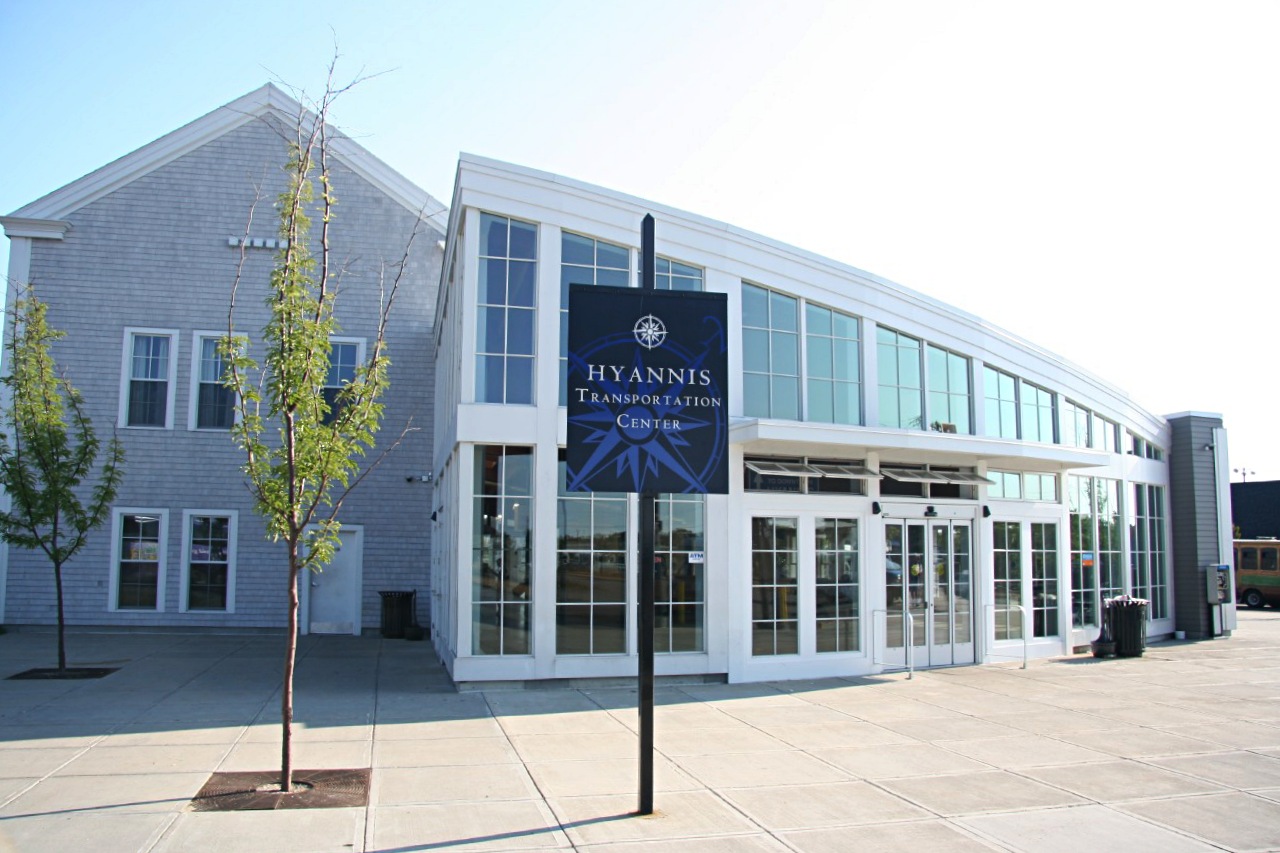
The Cape Cod Regional Transit Authority (CCRTA)'s Hyannis Transportation Center at 215 Iyanough Road is Cape Cod's major bus and train terminal and transfer hub.
The Cape Cod Gateway Airport (HYA) is 1.1 miles (1.8km, a 25-minute walk) to the north; the Steamship Authority's School Street car and passenger ferry docks are 1/2 mile (800 meters, 12-minute walk) to the south; and Hy-Line Cruises' Ocean Street passenger ferry dock is 7/10 of a mile (1.1km, 15-minute walk) south of the transportation center.
Cape Cod Regional Transit Authority
CCRTA bus routes (map) include:
- Hyannis Trolley (June, Juy, August) connecting the Hyannis Transportation Center with the ferry docks, Kennedy Memorial, Veterans' Beach and JFK Museum; and Hyannis Crosstown to shopping centers.
- Barnstable Villager, connecting the Transportation Center with the Airport, West Barnstable and Barnstable Courthouse.
- Sealine, connecting Hyannis to Falmouth and Woods Hole via Centerville, Osterville, Cotuit, Marstons Mills, Mashpee, and East Falmouth; also the Whoosh Trolley connecting Woods Hole to the Falmouth Mall.
- Provincetown Shuttle, connecting the town center with beaches, camping area, and North Truro.
- Sandwich Line, connecting Hyannis to Centerville, Marstons Mills, Sandwich, Sagamore, Bourne and Buzzards Bay.
- H2O Hyannis-to-Orleans connecting Hyannis, Yarmouth, Dennis, Harwich, Chatham and Orleans.
- Flex, Dart, SmartDart and ADA Paratransit services to destinations not covered by other lines.
Intercity Bus
Peter Pan Bus Lines
Peter Pan runs buses from Boston (Logan Airport and South Station) and Providence RI (Bus Terminal and Downtown) to Hyannis and Woods Hole, and with a transfer at Hyannis, to Provincetown, stopping at towns along the way. More...
Plymouth & Brockton Buses
Plymouth & Brockton also runs buses from Boston (Logan Airport and South Station) to Hyannis and Provincetown. More...
Train
CapeFLYER
The CapeFlyer train runs from Boston (South Station) to Hyannis Transportation Center each weekend (Friday to Sunday) from Memorial Day (late May) to Labor Day (early September) with stops at Braintree, Brockton, Middleborough/Lakeville, Wareham Village, Buzzards Bay and Bourne. The journey takes about 2-1/2 hours. Passengers can get out at the Bourne station and take ferry shuttles or ride-app cars to the Woods Hole ferry docks for Martha's Vineyard. Passengers taking ferries or flights from Hyannis continue to the terminus at Hyannis Transportation Center. More...
Cape Cod Central Railroad

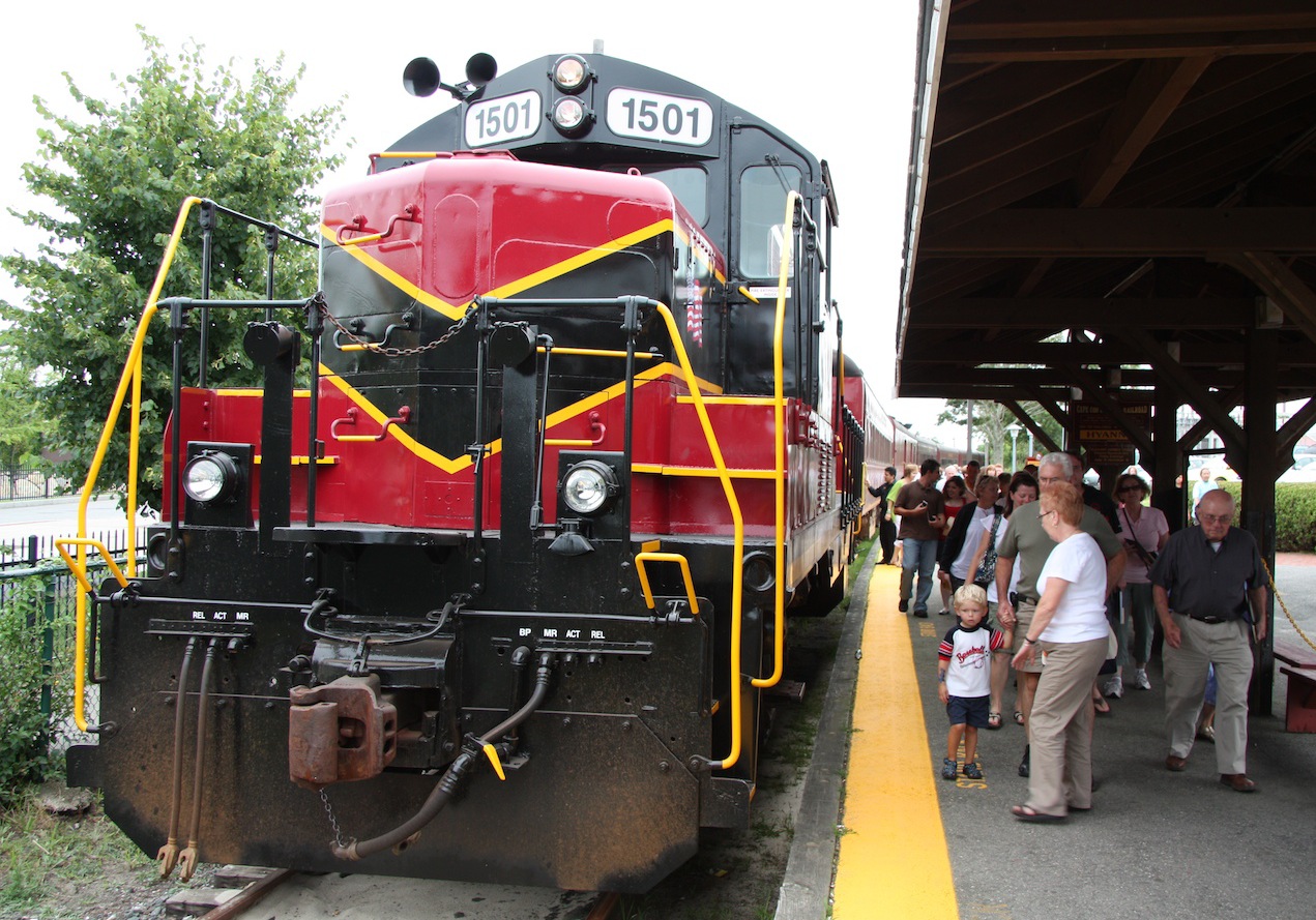
Cape Cod Central Railroad locomotive, Hyannis MA.
The Cape Cod Central Railroad runs excursion, luncheon, dinner and special-event trains from Hyannis Transportation Center (252 Main Street) to Buzzards Bay (70 Main Street) and back. It's all about the journey, not the destination, since you usually end up back where you started. Lots of fun! More...
Plane
Cape Cod Gateway Airport (HYA), fomerly known as the Barnstable Municipal Airport or Hyannis Airport, is located 1.1 miles (1.8 km, 25-minute walk) north of the Hyannis Transportation Center. CCRTA's Barnstable Villager bus can take you between the airport and Transportation Center, whence the Hyannis Trolley will take you to the ferry docks.
JetBlue
JetBlue flies in summer from New York City (JFK & LGA) to HYA.
Cape Air
Cape Air has flights from HYA to Boston Logan (BOS), Nantucket (ACK) and Martha's Vineyard (MVY).
Car
During the summer vacation season, car traffic to and on Cape Cod is often intense, with hour-long delays. Plan your driving strategy carefully, and avoid weekends if possible!
Avoid Times of Heavy Traffic!
The two graceful bridges spanning the Cape Cod Canal and connecting Cape Cod to the mainland (map), Sagamore Bridge to the northeast and Bourne Bridge to the southwest, were built during the Depression in the 1930s.
They were fully sufficient to carry all the traffic back then. Now, they act as a bottleneck to keep all but the truly committed from reaching the Cape.
In the summer months, avoid driving to Cape Cod (and trying to cross the bridges) on Friday between 2 pm and 9 pm (14:00 and 21:00), and on Saturday between 8 am and 2 pm (08:00 and 14:00).
On Sunday afternoon and evening from 3 pm to 10 pm (15:00 to 22:00) traffic leaving Cape Cod across the bridges is slow.
Cape Cod Tunnel
By the way, if you see bumper stickers advertising the Cape Cod Tunnel, you should know that it's a joke! Anyone ever caught in the traffic jams coming to or going from Cape Cod dreams of a big, fast tunnel under the Cape Cod Canal to speed traffic along, but there is no such tunnel, and there may never be.
Driving to Cape Cod
From New York City and Providence RI
Take I-195 to MA 25/28 South and cross the Bourne Bridge if you're heading for Falmouth and Woods Hole.
If you're going to Sandwich, Hyannis, or other Cape points, don't take the Bourne Bridge, but take US 6 East just before the Bourne Bridge, and this will take you north and east to the Sagamore Bridge, where you cross the canal.
From Boston and Plymouth
The Southeast Expressway (I-93) will take you right to MA 3, which goes straight to the Sagamore Bridge.
If you're on your way to Falmouth and Woods Hole, stay on I-93 past the intersection with Route 3 and take Exit 66 for Route 24 South, then I-495 South MA 28, before taking you right over the Bourne Bridge.
Driving on Cape Cod
Once you cross the Bourne or Sagamore bridge you'll have three major roads to choose from:
Mid-Cape Highway: US 6
US Route 6, the Mid-Cape Highway, is the fastest way to travel from the "Inner" (or "Upper") Cape" (the part you first come to by land) to the "Outer Cape" (or "Lower Cape"), the narrow portion north of Orleans to Provincetown). Hemmed in by forest, it is a four-lane limited-access divided highway from the Cape Cod Canal to Orleans (except for a 13-mile/21-km length of two-lane highway). North of Orleans it is mostly four-lane undivided highway to Provincetown.
The Alternate Route: MA 6A
US 6 is not the prettiest way to go, with views mostly of forests bordering the highway. MA Route 6A travels along the northern part of the Cape from Sandwich through the pretty, historic villages near Cape Cod Bay: Barnstable, Cummaquid, Yarmouth Port, Yarmouth, and Dennis before heading eastward to Brewster and Orleans.

MA Route 6A east of Sandwich: a pretty, meandering ride through shady groves and charming Cape Cod villages.
The stretch of MA Route 6A between Sandwich and Dennis is a lush panorama of bogs and marshes, distant views of dunes and the sea, birds calling and fluttering, the winding road dotted with antique shops, craft shops, art galleries, and other businesses including lots and lots of real estate offices.
Meandering MA Route 28
MA Route 28 connects the Bourne Bridge over the Cape Cod Canal to Orleans via Falmouth, Hyannis, West Yarmouth, West Dennis, Dennis Port, Harwich Port, and Chatham. This is Cape Cod's main east-west commercial highway along the southern part of the Cape, with shopping centers, stores, light industry, restaurants, amusements and lodgings interspersed with stretches of woodland, bridged rivers and salt marshes.
It is perhaps the slowest route because of heavy traffic and numerous traffic signals, but it leads to Cape Cod's greatest concentration of lodgings. More...
Signed as MA 28 North and South, these directions are accurate only for the stretch between the Bourne Bridge and Falmouth. After that the highway, signed as South, actually goes northeast, then east, and finally north from Chatham to Orleans. So if you want to go south and west from Orleans, you follow MA 28 North. Got that?
By Train & Bus from New York City
Amtrak runs about 10 trains daily between New York City (Moynihan Train Hall at Penn Station) and Providence RI. From Providence you can take a Peter Pan bus to Hyannis, and continue to Provincetown if you wish. More...
Peter Pan Bus runs six buses daily from New York City's Port Authority Midtown Bus Terminal to Hyannis along the Connecticut Shoreline via Mystic CT to Providence RI.
From Providence the route goes via Fall River, New Bedford, Bourne and Barnstable to the Hyannis Transportation Center.
Ferryboat
Boston <—> Provincetown
Bay State Cruise Company runs daily ferries between Boston and Provincetown (905minutes) in summer. More...
Plymouth <—> Provincetown
From late June through September, Captain John Boats operates a fast ferry from the Town Wharf in Plymouth to MacMillan Wharf in Provincetown (90 minutes). More...
Nantucket Ferries
Hy-Line Cruises
The Hy-Line Cruises company runs fast, comfortable passengers-only ferries from its Ocean Street docks (map) in Hyannis to Nantucket, and to Oak Bluffs on Martha's Vineyard island.
In the busy months of July and August, it's wise to reserve your seats on the ferries, even if only a few hours before your planned departure.
The alternative to the Hy-Line ferries is the Steamship Authority's passengers-only ferry, which departs from Hyannis's Pleasant Street docks (map), a 10-minute walk around the harbor from Hy-Line's Ocean Street docks.
You can also walk aboard the Steamship Authority's car ferry to Nantucket, but it's a bit slower than the Hy-Line ferries.
Steamship Authority
The Steamship Authority operates both car ferries and passengers-only ferries from its Pleasant Street docks in Hyannis on Cape Cod to Nantucket island.

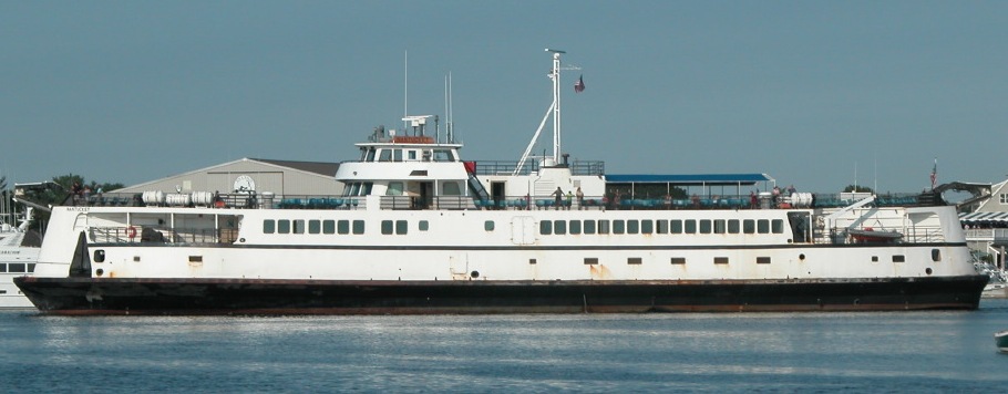
The Steamship Authority car ferry at the Pleasant Street docks in Hyannis.
It's expensive, impractical and hardly necessary to take your car to Nantucket for a short visit in summer.
The Steamship Authority operates the only car ferries between Nantucket Island and the mainland (Cape Cod): the 768-passenger, 52-vehicle m/v Eagle, and m/v Nantucket from the Pleasant Street docks in Hyannis.
You must reserve a space on the ferry well in advance and pay a minimum of $400 round-trip (vehicles up to 17 feet/5.18 meters), or $450 for vehicles 17 to 20 feet, such as full-size SUVs (Chevy Suburban).
Transportation on Nantucket can meet your needs. More...
Martha's Vineyard Ferries
Woods Hole Car Ferry
The Steamship Authority runs the car & passenger ferries from Woods Hole on Cape Cod to Vineyard Haven and Oak Bluffs (map) year-round. The 45-minute voyage costs $17 per adult, round-trip. More...
Falmouth Passenger Ferry
The m/v Island Queen passenger ferry sails from Falmouth Harbor on Cape Cod to Oak Bluffs on Martha's Vineyard seven times daily in summer. It's a comfortable, fun and inexpensive way to go.
Peter Pan buses from Boston arrive at Falmouth's Peter Pan Bus Terminal (map), 1.6 miles (2.6 km) west of the Island Queen Ferry Dock, a 30-minute walk.
Hyannis Passenger Ferries
Hy-Line Cruises operates six fast, comfortable catamaran passenger ferry trips daily in high summer between Hyannis on Cape Cod and Oak Bluffs on Martha's Vineyard. The voyage takes one hour.
In spring and fall there may be only two or three sailings per day in each direction. More...

