Lake Winnipesaukee NH Guide
The lake's long Native American name has been translated as Smile of the Great Spirit.
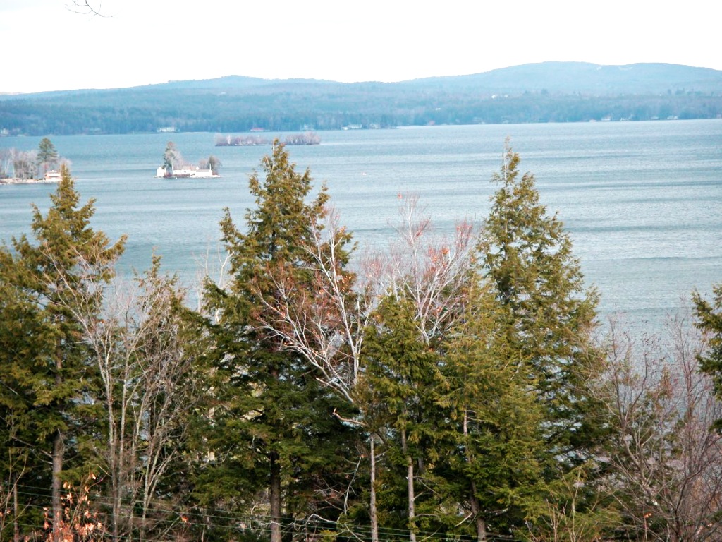
The "Smile of the Great Spirit"
About Lake Winnipesaukee
The largest of the lakes in New Hampshire's Lakes Region 95 miles (153 km) north of Boston (map), Lake Winnipesaukee is grand indeed: 2 miles (34 km) long, about 288 miles (463 km) of shoreline, 69 square miles (179 square kilometers) of water to swim in or boat on, 212 feet (65 meters) deep at its deepest point, and boasting 258 islands.
Named for the Winnipesaukee sub-tribe of the Penacook Native American people, the name of this glacial lake has been translated as Smile of the Great Spirit, and while the lake's irregular shoreline might suggest a wry grin rather than a sunny smile, the lake's large size would certainly do the Great Spirit justice.
Summer is when the lake is busiest with swimmers, boaters, fishers, water-skiers and the like, but winter snows draw crowds to the Gunstock Mountain Ski Resort in Gilford near the lake's shore.
Lake Cruises
The M/S Mount Washington begins its 2-1/2-hour cruises of Lake Winnipesaukee in Weirs Beach. Some cruises stops in Wolfeboro and Alton Bay to pick up and discharge passengers.
MS Washington boarding for a cruise on Lake Winnipesaukee.
Laconia & Gilford
Laconia (population 17,000), located 27 miles (43 km) north of Concord NH (map), is surrounded by lakes: Lake Winnipesaukee, Lake Opechee, Paugus Bay and Lake Winnisquam. It's the county seat of Belknap County (that's "bell-nap") and the largest town in New Hampshire's Lakes Region.
Right next to it is the town of Gilford, home of Gunstock Mountain Resort for winter skiing and summer fun.
Laconia has its own small general aviation airport (no scheduled flights). The nearest large airport with scheduled service is Manchester-Boston Regional Airport. More...
A Bit of History
Settled in 1761, Laconia prospered during the early 1800s because of water power which turned the wheels of its mills grinding wheat and corn, and sawing timber into lumber. The Belknap Mill for textile production opened in 1832, and is still in the town center next to the town hall, restored and open to visitors. It's the oldest unaltered brick textile mill in the USA, an important site of the early Industrial Revolution in New England. More...
Drop in to see the hydroelectric plant which ran the mill and supplied electricity to the town center from 1918 to mid-century. The mill now also serves as the region's center for culture and the arts.
Laconia Beaches
Laconia's Opechee Cove Beach in Opechee Park on Opechee Bay north of the town center (map) is the place for a swim.
Ellacoya State Beach, 280 Scenic Drive, Gilford, NH, on NH Route 11 in Gilford southeast of Glendale (map), is one of the nicest beaches on the lake. There's plenty of parking, and if you go early in the day you can get one of the picnic tables.
There's a snack bar, and a lifeguard is on duty all the time the beach is open.
The slope of the beach is very gradual, making it ideal for small children; for more experienced swimmers, a swimming dock floats in the water farther out.
Weirs Beach
Weirs Beach, 7 miles (11 km) north of Laconia (map) is the essential young-at-heart summer-fun town known more for its honky-tonk penny arcades, (see below), candlepin bowling alleys, pinball machines, fortune tellers, and fast-food stands than it is for the beauty of its beach.
Weirs Beach.
Pendleton Beach at Weirs Beach
Weirs Beach—the beach itself, actually known as Pendleton Beach—on Route 11B near its intersection with US 3 (map), is a town beach with free parking at several lots in the town of Weirs Beach (look for the signs to the free lots—everything on the main street is metered and you pay by the hour).
A number of the hotels, inns and resorts in town have their own stretches of beach.
Amusement Arcades
The amusement arcades are open during the day and in the evening in summer, and give the town a character that differs greatly from what it once must have been: the grand old turn-of-the-century mansions around the town are some of the finest of their genre, with lots of cupolas, turrets, gables, and all the other paraphernalia that make late-Victorian architecture so intricate.
Wolfeboro
Wolfeboro NH, at the southeastern end of Lake Winnipesaukee 29 miles (47 km) by winding roads east of Laconia (map), is proud to call itself "the oldest summer resort in America," because in 1763 Governor John Wentworth built here the first summer house in the United States.
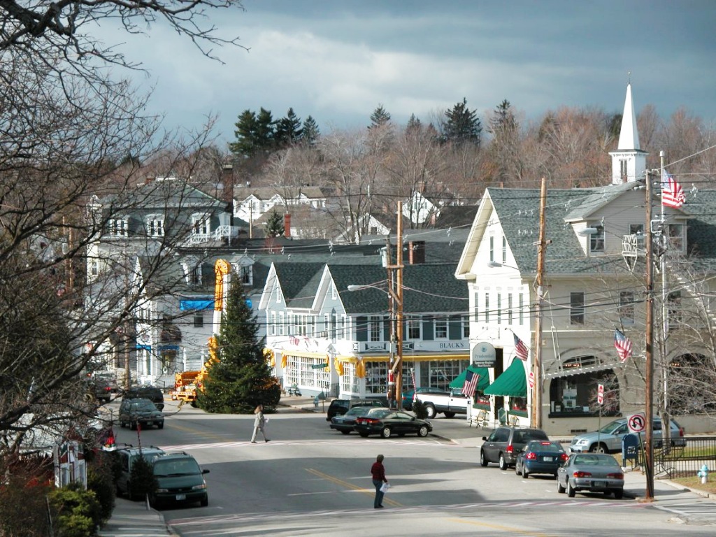
Wolfeboro, New Hampshire
It is among the prettiest and most interesting towns on Lake Winnipesaukee, pretty enough to attract famous visitors such as President Nicholas Sarkozy of France (August 2007), as well as former Massachusetts governor and US presidential candidate Mitt Romney, who owns a Wolfeboro summer home.
A reason for Wolfebro's beauty is that it was never industrialized in the 19th century, thus escaping the post-industrial decline that hit such textile-producing towns as Laconia.
It has escaped the honky-tonk commercialism that has taken over some other lake towns, like Weirs Beach, perhaps because of its "inconvenient" position at the southeastern tip of the lake.
So today Wolfeboro is a fine, almost typical, New England town with the requisite historical society, white-steepled churches, gracious old houses, and some fine views of the lake.
There is less hustle and bustle in Wolfeboro than in some other lake towns, less to "see and do," but that makes it all the better for those who really want to relax.
Libby Museum
Dr Henry Forest Libby, a Boston dentist who was born and raised near the shores of Lake Winnipesaukee, devoted the latter part of his life to the study and collection of natural history specimens: fish, animals, and birds.
Other interests of his included early Native American lore of the region, and artifacts from the times of early settlers. All these diverse exhibits are brought together in the Libby Museum at 755 North Main Street (NH Route 109; map), three miles north of Wolfeboro. More...
Castle in the Clouds
Around the turn of the century Thomas Gustave Plant (1859-1941) decided to build a retreat in the Ossipee Mountain range of the New Hampshire wilderness for himself and his wife, Ms Olive Plant. While he was not alone in this—lots of rich men were building lavish estates in the region—his accomplishment, finished in 1914, is certainly among the grandest.
The Arts and Crafts-style mansion was designed by J Williams Beal & Sons of Boston, cost millions of dollars to build, and was named Lucknow after a castle in Scotland. The name comes originally from a city in India).
Today Lucknow is called Castle in the Clouds, and is owned and operated by the Castle Preservation Society, a non-profit organization. The 135-acre estate's grounds are beautiful, and the view of the mountains and lakes is nothing short of spectacular.
The remaining 5,245 acres (2,123-hectares) of the lands once owned by Thomas and Olive Plant are under the control of the Lakes Region Conservation Trust. Hiking trails, 28 miles (45 km) of them, wind through the estate; horseback trail rides, pony rides and horse-drawn carriage rides are daily events.
Castle in the Clouds features the Carriage House Restaurant, Cones in the Clouds ice cream shop, and a gift shop.
Follow NH Route 109 north from Wolfeboro for 17 miles (27 km), turn right (east) onto Route 171, and go 3 miles (5 km) to the entrance of the estate (map).
Cardigan Mountain
From Laconia, it's a 1-hour, 40-mile (64-km) drive to 658 Cardigan Mountain Road (map), the trailhead for a hike up Cardigan Mountain.
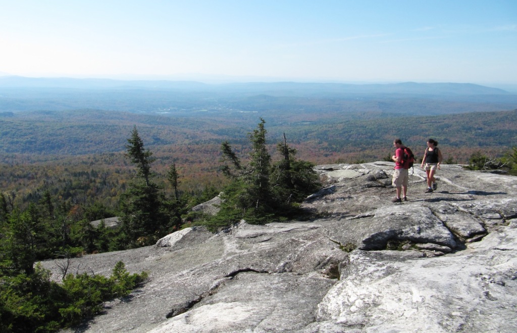
Panoramic view from the summit of Cardigan Mountain.
Cardigan Mountain (3155 feet/962 meters), 18 miles (29 km) due east of Lebanon in Orange, New Hampshire (map), offers an appealing 3-hour mountain hike to the summit and back.
Approaching the mountain by car from the west through the small town of Orange NH, climbing up the narrow mountain road, Mount Cardigan shows a bare summit of metamorphic rock from which you can enjoy fine views of the region.
IMPORTANT!
You have a choice of two base trailheads for your hike: the Cardigan Mountain State Park trailhead parking lot at 658 Cardigan Mountain Road on the west side of the mountain, or the Appalachian Mountain Club's Cardigan Lodge & Reservation on the east side at 774 Shem Valley Rd, Alexandria, NH—20 miles (32 km) by road from one to the other! (map)
Be sure to descend the mountain on the side you ascended! Yes, it seems simple, but too many hikers start down from the summit in the wrong direction and end up at the wrong base camp with no way to go around the base to their cars!
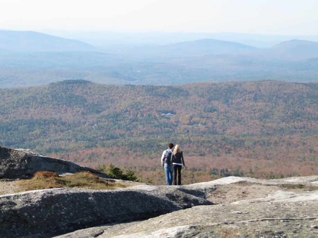
Are you certain that's the way you came up?
If you end up at the base on the east side at 4 pm when your car is on the west side, 20 miles (32 km) away by road, what will you do? You certainly don't want to go over the mountain again in the dark.
Double check that you are descending on the trail by which you climbed the mountain!
Cardigan Mountain State Park
Cardigan Mountain State Park, located in the 5000-acre Cardigan Mountain State Forest on the western slopes of the mountain, has a parking area at the trailhead, picnic tables (one beneath a shelter, several with charcoal grills), and pit toilets. An information board shows you the lie of the land, and simple printed trailmaps are yours for the taking. There is no cost for admission.
What to Bring
The park has no water supply or other services, so bring everything you need for your hike, especially a big water bottle. (Several springs and small streams along the trail may do for water in an emergency.) Also, carry out everything you bring in: there are no trash receptacles.
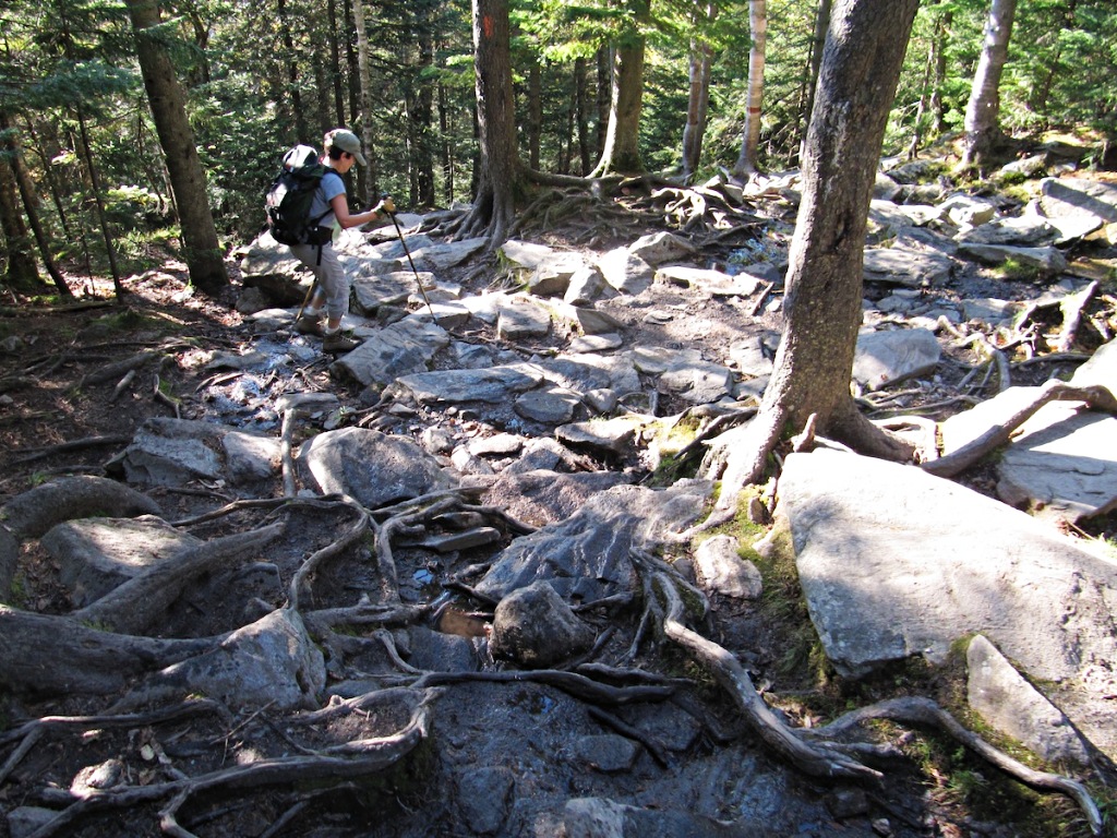
Typical New England mountain trail: lots of roots and stones....
Stout shoes and sturdy clothing are a good idea, as is some sandwiches or at least a supply of energy snacks. You may want to have sunblock and a windbreaker for the summit, where it will be considerably colder than at the base, and certainly windy.
The 1.5-mile (2.4-km) climb to the summit, a vertical ascent of 1000 feet (305 meters) takes about 1-1/2 hours—at least it did for me when I was a guy in his 60s who was not in bad shape, but not an athlete. Figuring a half-hour to enjoy the view at the summit, and an hour to descend, the total hiking time is about 3+ hours.
Making the Climb
The wisest plan is to begin your hike in the morning, before 12 noon at the latest, just in case something goes wrong (missed trail turn, sprained ankle, etc.) and you need extra time for your descent. You don't want to be on the mountain when it's dark.
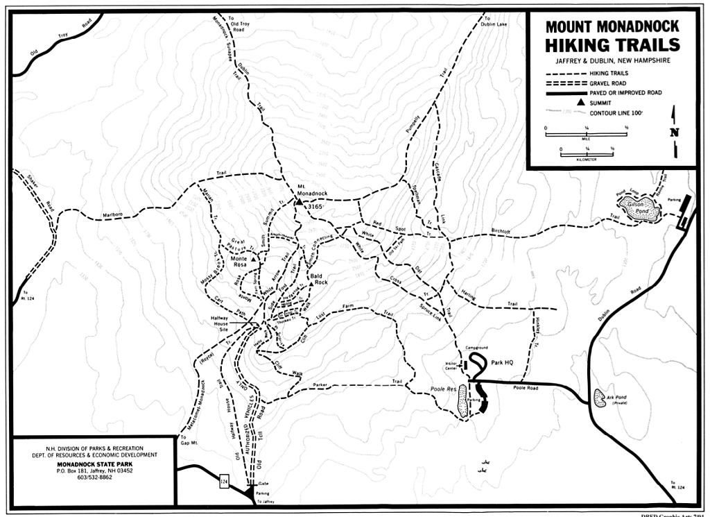
Click on the Trails map to download a larger version.
The West Trail, starting at 658 Cardigan Mountain Road and marked by stone cairns all the way to the summit, is the shortest and most favored path. It's also the fastest way down in an emergency or severe weather.
This is not exactly a stroll-in-the-woods. The rocky, root-strewn path gets difficult and steep in a few spots, and you must clamber over some boulders. There may also be patches of mud and muck.
At the Summit
The bare summit, above treeline, is topped by a fire lookout tower, usually locked up tight. There is no shelter at the summit.
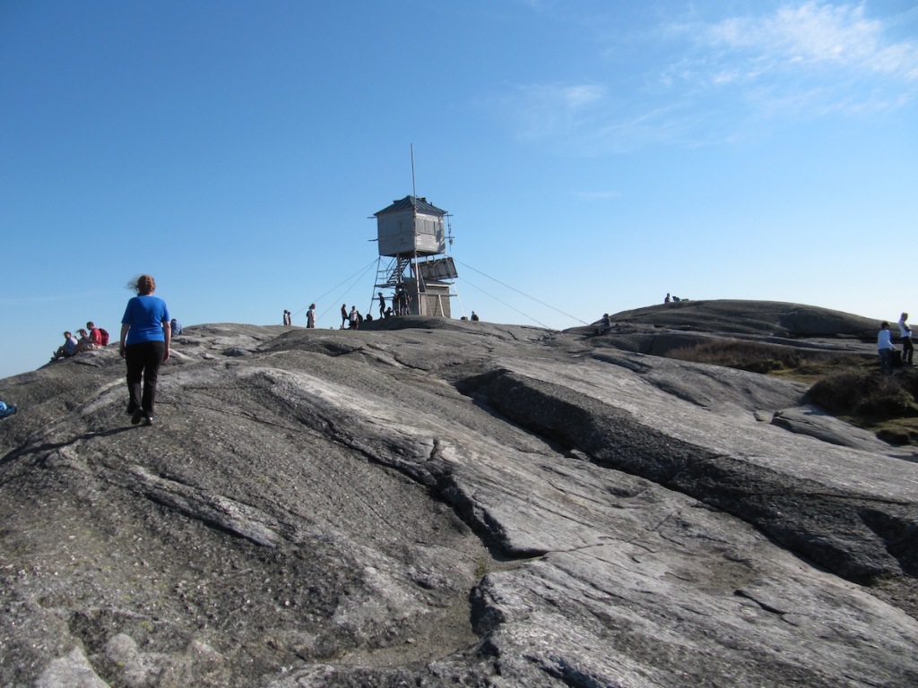
On a clear day, the panoramic views are spectacular, with vistas all the way to Camel's Hump mountain in Vermont and Mount Monadnock to the south.
AMC Cardigan Lodge
On the eastern slope of the mountain, approached from Bristol and Alexandria NH, the Appalachian Mountain Club's Cardigan Lodge, 774 Shem Valley Rd, Alexandria NH, offers hikers and campers private rooms with private bath, bunkrooms with shared bath, and individual and group walk-in tent sites.
AMC Cardigan Lodge
Hearty, healthy meals are served in summer and autumn, and on winter weekends.
Multiple hiking and cross-country ski trails depart from the lodge through the AMC's 1200-acre (486-hectare) reservation, including trails to the summit of Cardigan Mountain. These eastern slope trails to the summit are longer than the West Trail from 658 Cardigan Mountain Road.
Other than the summit, the Lodge is the trailhead for two short nature trails and the longer, atmospheric trail to Welton Falls, 30 to 60 minutes' hike from the lodge (75 to 120 minutes round-trip). More...
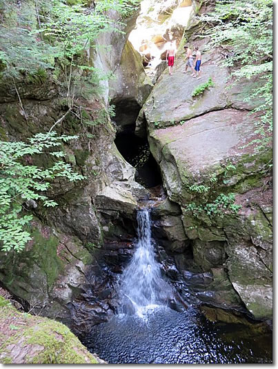
Welton Falls, Cardigan Mountain, New Hampshire.
Note the people in the upper right-hand corner of the photo.
The AMC High Cabin, near the summit, is great for back-country groups.
Where to Stay
If you don't stay at the AMC Cardigan Lodge, consider the Henry Whipple House in Bristol NH (map). A 1904 mansion now run as a bed-and-breakfast, the Whipple House has five comfortable, atmospheric guest rooms with bath, and three suites. Breakfasts are delicious and Sandra, the innkeeper, is an avid hiker who can advise on all the region's trails. More...
Use this handy Hotel Map with Prices to find the lodgings you want in Bristol, Ashland, or nearby towns.
Transportation
Although car is the easiest way to reach Lake Winnipesaukee, there is bus service; and the Manchester-Boston Regional Airport is an easy rental-car drive away.
Car
Laconia, Lake Winnipesaukee's major commercial and administrative town, is 95 miles (153 km) north of Boston (map).
Interstate 93 is the major highway north from Boston to the lake. Take Exit 20, then NH Route 11 East from Tilton toward Laconia.
From Portsmouth NH, take the Spaulding Turnpike (NH Route 16) north to Rochester NH, then NH Route 11 west to Alton and the lake.
Distances: Laconia is 24 miles (39 km) north of Concord NH, and 56 miles (90 km) south of Franconia Notch NH.
Bus
Concord Coach Lines runs daily buses between Boston's South Station Bus Terminal and Berlin NH, stopping at the Lake Winnipesaukee towns of Tilton Junction, New Hampton, Meredith (map), Center Harbor, and West Ossipee. More...
In Meredith the bus stop is near the Aubuchon Hardware store on the Daniel Webster Highway (NH 25/US 3), near the intersection with the Whittier Highway. From Meredith, you continue your trip by taxi or rideshare app car.
Airports
The closest major airports with scheduled service are Manchester-Boston Regional Airport (MHT), 51 miles (82 km) south of Laconia, and Boston-Logan International Airport (BOS), 97 miles (156 km) south of Laconia.
Lake Winnipesaukee has a small general aviation airport: Laconia Municipal Airport.
Lakes Region Airport Shuttle
Based in Tilton, this shuttle company (tel: 888-386-8181, info@LRSTNH.com) serves Manchester-Boston Regional Airport; Boston's Logan International Airport, South Station Transportation Center, and Flynn Cruiseport Boston. More...
Train
New Hampshire's only scheduled intercity train services in New Hampshire are:
— Amtrak's Downeaster between Boston MA and Brunswick ME, stopping at Exeter, Durham and Dover NH. (Dover is 46 miles (74 km) southeast of Laconia.) More...
— Amtrak's Vermonter, stopping at Claremont NH and, perhaps more conveniently, at White River Junction VT, just across the Connecticut River from Lebanon NH. More...
